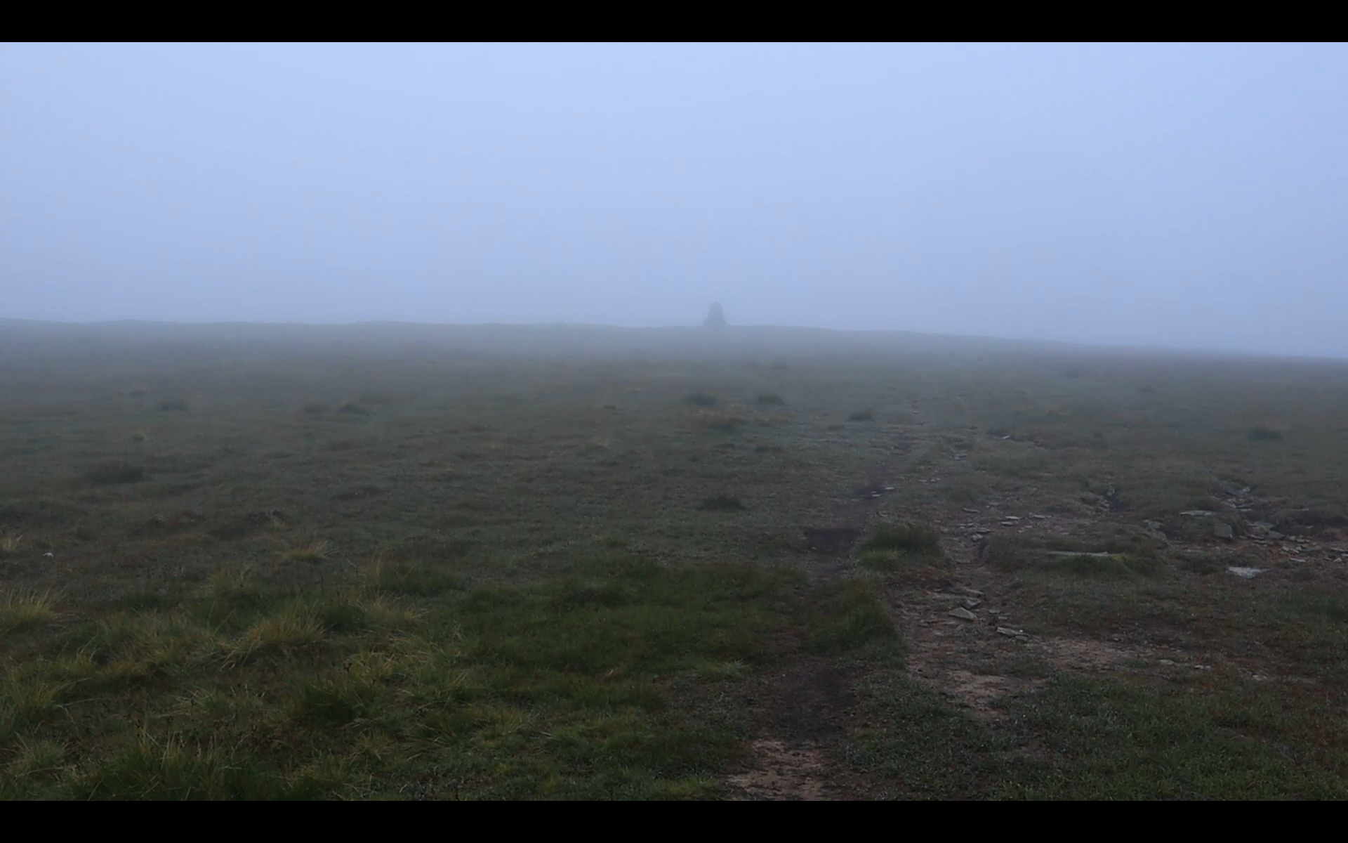
Waking early, I could hear the wind which had picked up in the night and lead to lots of creaking throughout the bothie. I was currently nice and dry inside and knew, that as soon as I ventured outside, I would be soak instantly. It wasn’t raining but I was fully submerged in a low cloud. Stuffing my sleeping bag away, I donned water proofs. I sampled the weather whilst I brushed my teeth and was not looking forward to the final summit over the fell.
Braving the elements, it was a steady climb to highest point of the Pennine way and 2nd highest point in England – outside of the Lake District. I tried to avoid the bogs but to no avail, they were well and truly everywhere. A few flagstones helpfully aided us hikers but my shoes and feet were done for. I relied on my GPS to lead the way as the trail disappeared and the fog enveloped everything. Zigzagging down the fell, the flagstones magically reappeared and I was able to happily follow them to lower elevation. Rounding a bend, I halt as a radio mast and station appeared out of the flowing mist, it feels odd to find signs of human activity this high up. A road sits in front of the station and I take to it knowing that I can join up with the Pennine way shortly.
The left side of my body is well and truly soaked. A pick-up truck loomed out of the whiteness as two workers in high-vis jackets speed past on their way to the radio mast. I must have been quite the sight. Trudging onwards, I kept to the road until it crossed paths with a trail that would lead me back to the Pennine way. Thankfully everything was down hill and I eagerly clocked up miles and got down from the blustery fell. Reaching the bottom, the wind had died away and the clouds had dispersed. I was super happy to be able to peel off my sweaty waterproofs and sit down for a spot of breakfast. I’d stumbled upon a pleasant looking church and sat a while in the peaceful grounds. Someone had recently tended to it as the grass was short and offered me a comfy and dry place to sit. I devoured half a packet of chocolate digestive biscuits and scanned my guide book, taking in the next section of the trail.
I hike in and out of Dufton. A few hikers meander about about to begin their ascent of Cross fell. My mountain involves climbing Nicks cup which turns out to be very epic and also very windy. I have a quick look over the landscape before battling on in the wind. four hours later I traverse over moorland, down a gravel road and emerge beside an impressive dam. I am relieved to be out of the wind and sit down to enjoy a late lunch only to be joined by midges… I sign, pack up and walk in. The flowing river is beautiful and would make a nice, secluded spot to camp – if you were able to get your tent up in time and get in before the midges swarmed.
I follow the flowing river as it meanders by farms and a quarry. A few lone dog walkers are out as the late afternoon approaches. I start looking for places to camp and pass families out for a evening walks. Pine forests line the river bank and I find a stunning spot. Flat and sheltered by the trees but it feels too exposed so I continue on until somewhere more secluded pops up. It’s quite noisy beside the rush but I soon fall into the land of nod.


Discover more from Keïteï Ventures
Subscribe to get the latest posts sent to your email.

